Here are three near-to-Sydney adventures (AWD and/or 4WD friendly) that you can do for fun, adventure and as an enjoyable way to hone your off-roading skills – without risking any damage to your vehicle or ego.
As always: drive sensibly (within your skill limits and the capabilities of your vehicle), exercise caution and if a sign says ‘4WD only’ then pay attention to it. There are generally more difficult – and sometimes unofficial – tracks off the side of the main tracks you will use or discover on these trips, but tackle those at your own peril.
Southern Highlands sojourn
Destination: Wombeyan Caves
Distance from Sydney: 180km / Approx. two-hour drive
Vehicle: AWD, 4WD (even 2WD)
Skill level: Beginner
Striking an ideal balance between relaxing getaway and low-key but thrilling adventure, a trip to the Wombeyan Caves is always capable of presenting a new surprise to visitors.
Camping by a river, off-roading and marvelling at one of the more than 200 caverns here make up some of the region’s undeniable appeal.
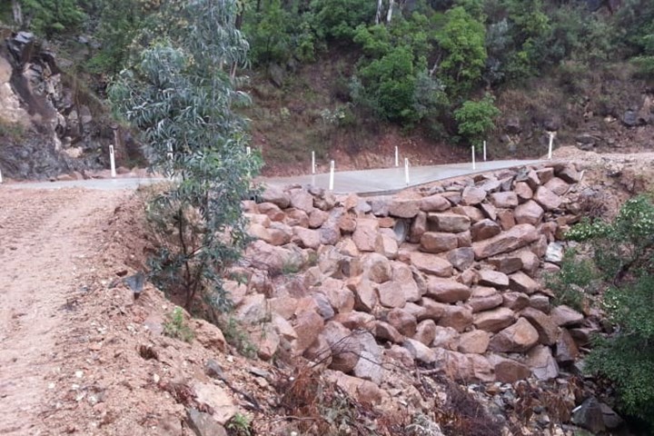
Tourers can access Wombeyan Caves Road in the Southern Highlands from Mittagong or Berrima, 120km south-west of Sydney, or it’s a 77km trip from Wollongong. Now you’re in Nattai and Blue Mountains national parks. Be aware: the road here is a twisting-turning, unsealed one that can be quite rutted in places. It is also quite narrow and there are numerous blind corners so it is good bush etiquette to sound your car horn on approach to one of these, in order to warn oncoming vehicles.
The track is in generally good nick – it cops a fair bit of traffic – but there are spectacular views into Burragorang Valley along the route here, so be prepared to be astounded.
The Bullio Tunnel, a 25-metre-long tunnel hand-cut into the sandstone in 1899, is another stop-worthy sight. It is on another blind turn so watch out for vehicles. Having said that, we’ve staged many vehicle photo-shoots there without a problem – it really is a great spot.
From Berrima to the caves, at the southern end of the Blue Mountains National Park, is about 65km or so. Camping is permitted here at Wombeyan Karst Conservation Reserve, for a fee, or there are cabins.
There are five caves here – Fig Tree, Wollondilly, Junction, Kooringa, and Mulwaree – and tours available for every one; Fig Tree is self-guided.
Once you have had your fill of stalactites, stalagmites, helictites and cave coral, if you’re not staying at the cave site, then back-track 15km and camp at Wollondilly River Station; a glorious pet-friendly spot with fire-pits, great views and plenty of amenities. Here’s a tip: book ahead of time.
Smiles away from the big smoke
Destination: Yengo National Park
Distance from Sydney: 130km / Approx. two-hour drive
Vehicle: AWD / 4WD (4WD only on the Mount Yengo Loop Trail)
Skill level: Beginner / Intermediate (the 4WD Only Mount Yengo Loop Trail can get tricky in wet weather)
Much of Yengo National Park’s appeal lies in the fact that it’s only a stone’s throw from Sydney – if you can throw a stone about 130km north-west of Sydney’s CBD. That’s how far away the park’s northern section is and that’s where we were headed.
In real terms, it’s less than a lazy, two-hour drive from Sydney or Newcastle – the park is actually in the Lower Hunter region. Once you’re out here, you really do feel like civilisation is a million miles away.
Yengo, part of the Greater Blue Mountains World Heritage Area, is 154,328ha of thick bushland, peppered with craggy gorges and open grassy areas.
It’s a country-cool mix of Aboriginal cultural heritage, 4WD touring, mountain-biking, bush-walking, horse-riding and even birdwatching, if you’re that way inclined. The potential for adventure here is always high. The bonus of Yengo is that, if visitors take their time, biking, hiking and even climbing (in Wollemi) is on the agenda.
We drove into Yengo from the east near Bucketty, via one of the park’s several access points. We headed for the Big Yango precinct of the park, winding our way along tidy gravel roads to the start-point of our adventure proper: the 4WD-only Big Yango Loop Trail. (Note: you need to have paid for a permit to access the Loop – there is a locked gate a few kms back at the start of the Big Yango access track – which means you’ll either have chosen to stay at Big Yango Homestead, or camp at Blue Gum or Mountain Arm campgrounds.)
There are plenty of gravel roads and dirt tracks on which to take an AWD – and the park is no less enjoyable if you do – but if you want to do the Loop, make sure you’re in a 4WD.
We slipped past the homestead and down along a few sandy stretches before ducking into deep bush to tackle the Loop. Kangaroos were our trackside companions.
The Big Yango Loop is 22km long and circles Mount Yengo, a table-top mountain dominating the park and held in high spiritual regard by the Wonnarua, Awabakal, Worimi and Darkinjung Aboriginal groups.
The track must be driven one way in an anti-clockwise direction. Remember: this is 4WD only. It is steep and rocky in places, with plenty of ruts and wash-outs to keep a driver switched on. There are tight switch-backs, slippery climbs and tricky downhill runs. Washaway track shoulders, drop off to dense scrubby bush.
Yengo is blanketed in ironbark and dry eucalypt forests. The tunnels of bush were broken periodically by small windows offering sneaky and spectacular views of the surrounding bushscape.
The track is firmly on the right side of difficult in several places, especially if there’s been rain or a storm’s brewing. There are rock steps that will, when wet, become slip-backwards hazards if driven without focus.
There are greasy clay climbs that will, in rain, offer little to no traction for vehicles on road tyres. There are creek crossings that can swiftly turn nasty with heavy rain and might be impassable in a non-modified 4WD. But this Loop was great fun to drive.
The Loop is rated as ‘medium difficulty’. It won’t test experienced four-wheel drivers or modified 4WDs, but it’s a shedload of fun. And, as always, bad weather changes everything.
Creek crossings here can deepen seemingly in seconds when there’s heavy rain; if they do, your way out, your escape route back to civilisation, is potentially cut off. There’s no mobile-phone reception here, so calling help would prove difficult.
No matter, go there, have fun, and wear your gone-bush grin with pride.
Hit the beach
Destination: Stockton Beach
Distance from Sydney: 170km / Approx. two-hour drive
Vehicle: AWD / 4WD
Skill level: Beginner / Intermediate
This is it: the sandy Holy Grail of off-roading. Stockton Beach, 170km north of Sydney on the M1, and 17km from Newcastle, is a 32km-long stretch of moving sand dune beach, from Newcastle Harbour to Anna Bay.
It comes under the auspices of Worimi National Park, which is part of the Worimi Conservation Lands (WCL) and its Indigenous owners/managers.
Sure, some of Stockton Beach has been closed off in order to help rehabilitate the dune system after a couple of big storms in recent years and public over-use damage to the region, but there is still plenty of fun to be had in the Recreational Vehicle Areas. Some of Stockton’s dunes top out at more than 30 metres high, so it’s a good bet you’ll find something to your liking.
Driving is permitted along the beachfront from about 5km north of the Lavis Lane access point (where the Sygna shipwreck sat from 1974 until mid-last year) to the Gan Gan Road access frontal dune-crossing, to the north.
Experience the thrill of blasting along the beach at speed, legal speed, that is: 40km/h on the beach or 20km/h when passing vehicles or people. There’s nothing like a solid session of beach driving to blow the city cobwebs out of your head.
Beyond that, you can while away your visit with scuba-diving, surfing, swimming – watch out for the sharks! – and fishing.
There are also culturally significant Aboriginal midden sites, shipwrecks, and Tin City (aka the Shacks), a group of huts built by fisherman, about 10km from the northernmost end of the beach.
Camping, at time of writing, was not permitted on Stockton Beach.
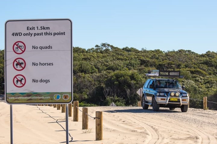
For your Stockton visit, make sure you have a Beach Vehicle Permit, use only WCL-designated vehicle access points (Lavis Lane near and Gan Gan Road), and stay on defined routes. Avoid driving along the beachfront an hour or two either side of high tide.
This article originally appeared on CarsGuide.


